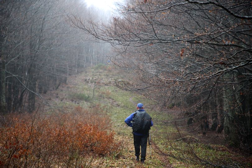
Our first tour to follow the entire border between Slovakia and Ukraine started in Poland, at the parking lot Przełęcz Wyżniańska (855m) in the Carpathian Mountains from where you can hike to the threepoint Poland-Slovakia-Ukraine. The last kilometer runs along the PL-UA border. I guess it will be an attractive hike during sunny days but the weather on this Sunday in April 2019 was very bad: we had rain the whole day, it was cold, cloudy and outside the wood it was very windy. After the two hours hike when we reached the tripoint Kremenec at 1221 meter we were soaked.
On this first day we went until BM 8, where it goes steep down to the small river Stružická rieka / Стужицька.
The way back to the car was the same, although we didn't have to climb that much.
The second day when we had much better weather we started our hike in Nová Sedlica and approached the border from the south side of the small river Stružická rieka.
|
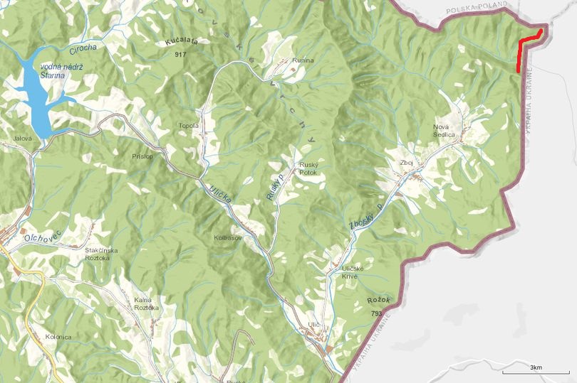
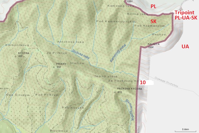
Map 1-10 Starting at the tripoint Kremenec, ending near the river Stružická rieka.
|
|
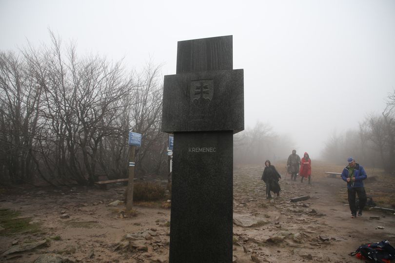
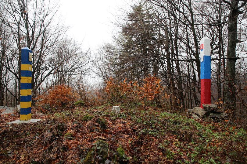
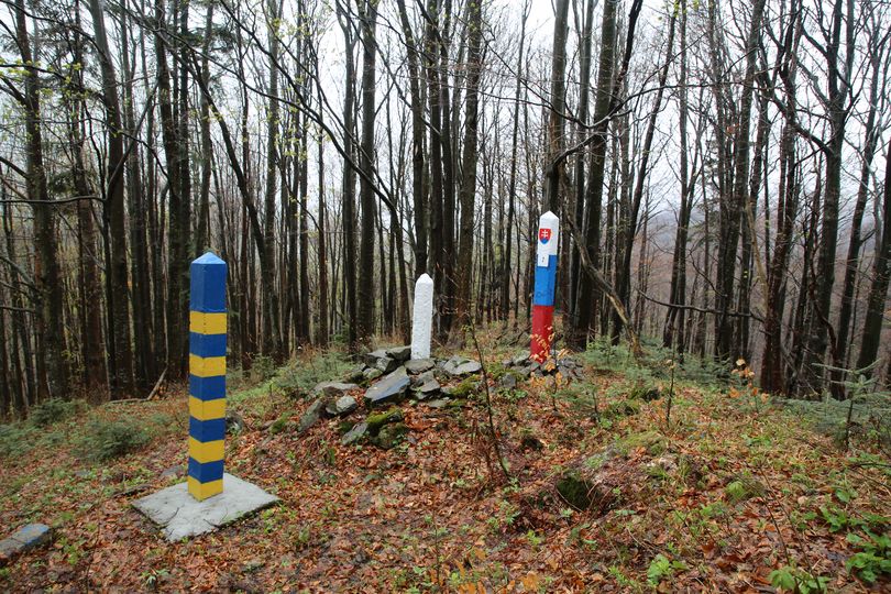
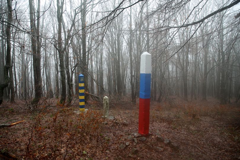
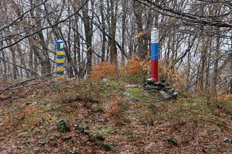
Tripoint PL/SK/UA (Kremenec) In the middle of the Bieszczadzki Park Narodowy (Bieszczady National Park) on the top of the Kremenec-hill in the Carpathian Mountains there is the tripoint at about 1205 meters. A very sad look on this grey and rainy Sunday. It looks this is an attraction on sunny days. On the tripoint there is a triangular stone. This is the Slovakian side. Although it's forbidden to cross the border to Ukraine, visitors violate that rule massivly. Everywhere you see small paths and traces to the Ukrainian border markers, at least between Poland and Ukraine. I read on the website of the Polish Border Guard service you get a penalty when they catch you. But on this windy day no Border Guards and hardly visitors.
|
|
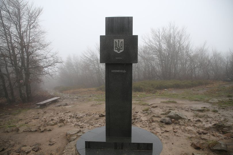
Tripoint UA (Кременець) The Ukrainian side of the border. This looks like a tolerance zone so we took the chance to take a picture of the triangular stone from the Ukrainian side.
|
|
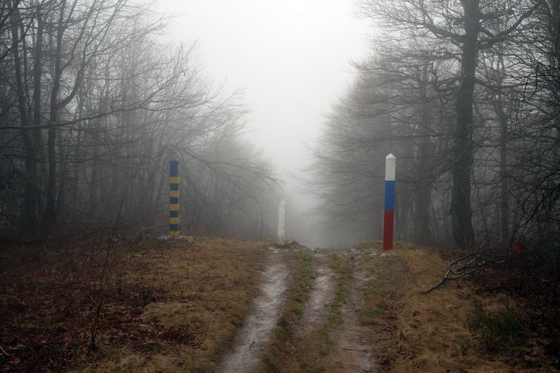
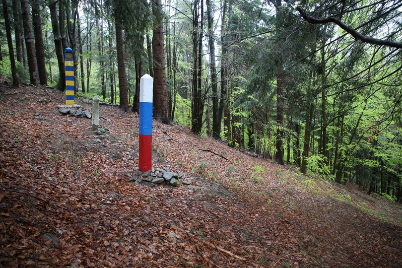
Border marker 1 As soon as you leave the area of the tripoint along the SK-UA border, it's the end of the touristic route. Only a small path without traces leading to the Ukrainian side.
|
|
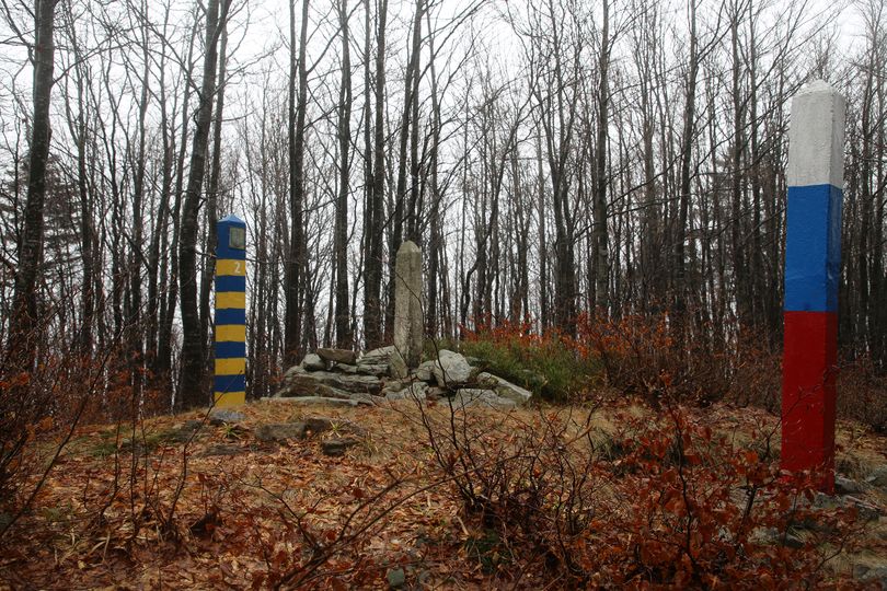
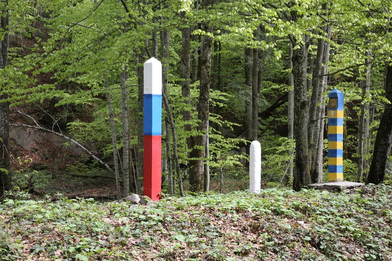
Border marker 2 The first angle in the border. You can see a lot of stones on the border itself. We saw that on more places, most propably these are old indications of the border.
|
|
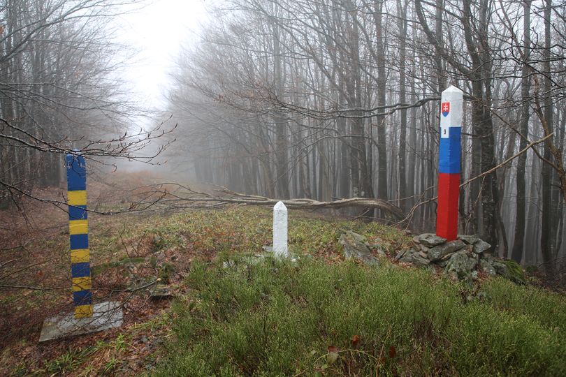
Border marker 3 Misty and grey. The border is in an open space. That makes it easy for us to follow the border. On the second picture you see Eef Berns somewhere between BM 2 and BM 3. Of course hiking on the Slovakian side.
|
|
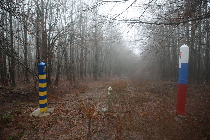
Border marker 4 We are still on a high altitude here. As you can see, the trees have no leaves here yet.
|
|
Border marker 5 TEXT
|
|
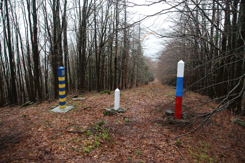
Border marker 6 On a small hill these border markers.
|
|
Border marker 7 Another angle in the border, covered by border markers and and an old pile of stones.
|
|
Border marker 8 We went down from the tripoint to here for about 400 meters. Trees have leaves here already, so it will be a bit warmer here. The next BM is on the other side of the creek 'Stružická rieka' which is even 170 meters lower and which you cannot cross without being soaked. So from here we went back to our car in Przełęcz Wyżniańska (Poland). It was a long and very rainy hike today. After this hike we drove to Snina in Slovakia where we had our hotel for the next days. The next morning we started our hike in Nová Sedlica to end up at number 9.
|
|
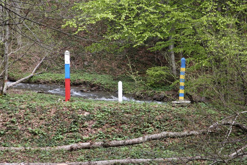
Border marker 9 In the small valley of the creek 'Stružická rieka' (635 meters above see level). On the second picture you see the distance between creek and the markers.
|

|
Border marker 10 It's a short distance but a huge ascend of 135 meters from BM 9 to here. And then you are only halfway to BM 11. This picture was taken uphill. I'm glad I have some training and experience in climbing these hills.
|
| 1-10 | 11-20 | 21-30 | 31-40 | 41-50 | 51-60 | 61-70 | 71-80 | 81-90 | 91-100 | 101-200 | 201-300 | 301-375 | HU-UA | RO-UA | MD-UA |