|
Lutepää
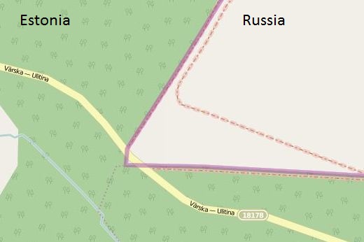
This is probably the most remarkable part of the border between Estonia and Russia. The road from Värska via Lutepää to Ulitina goes
through Russian territorium twice. I think this
is the only part of Russia that you are allowed to stay without a visa. Although, it's forbidden for pedestrians and it's forbidden to stop
on the Russian part of the road. So you cannot stay their for long. I wonder if it's allowed to go there by bicycle.
I also wonder how the Estonians and Russians will treat this
confusing and bit risky part of the border in their current process of demarcating the border. The easiest is to place a fence on both sides of
the Russian part of the road or to make a new road, avoiding Russian ground.
But now, this situation still exists. For me, it's a proof that both countries didn't fear their neighbours. This construction would be
impossible for the Polish - Russian border for example. |
|
|
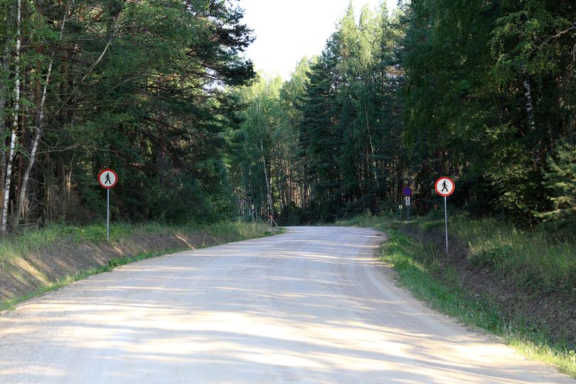
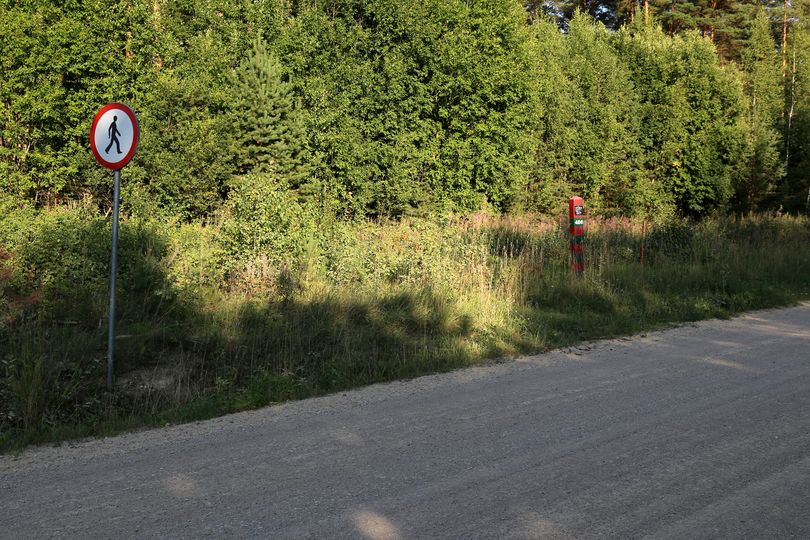
First zone Here the road crosses the Russian territorium only for about 10 meters. On the road it's announced 'forbidden for pedestrians'. |
|
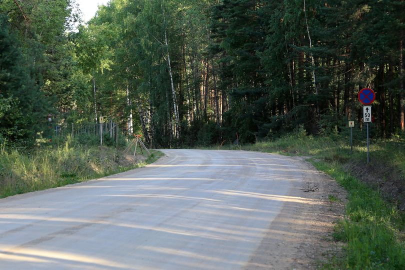
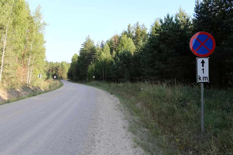
Forbidden to stop The next sign says forbidden to stop. The area is only 50 meters, so it's clear it's only a very short part of the road that's in Russia. You can also see it on the map. |
|
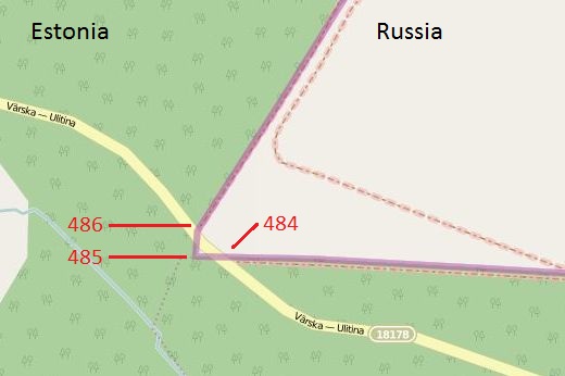
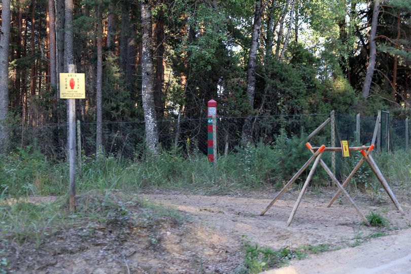
Border pole 486 On the left side of the road (travelling north->south) you will find this borderpole 486. On the right side there is also a bordermarker, that must be 485. Here the border makes an angel and crosses the road once again. I couldn't make a picture of it, as I was not allowed to stop or to leave the car. As this is an area with high risk, you can expect any moment a border guard appear from nowhere arresting you. Not for me this time! |
|
Border pole 484? After crossing the road, there is one more border pole on the left side. I guess that's 484 or maybe 483.The number is on the 'blind' side, so not visible from the road. The little shed you see, must be on the Estonian side. |
|
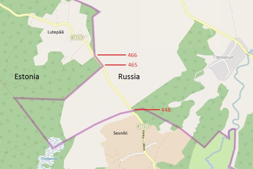
Zone two Some kilometers ahead, just after passing the village Lutepää, therse is a similar situation. Here the section where not to stop or to walk is longer, one kilometer. |

|
Situation on map On this map the situation gets clear. I arrived from the north. |
|
Border pole 466 The border comes from the left and goes prallel to the road for about 100 meter. Border marker 466 indicates the first 90 degrees angle. That means this part of the road is still Estonian, but the border is very close to the road. |
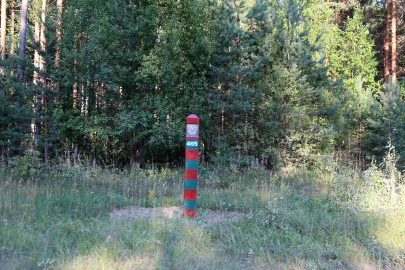
|
Border pole 465 Border pole 465 marks the second angle. Now the border crosses the road. When passing this marker you enter Russian territorium. The picture is not sharp, I know. I had to take it driving and through the window... |
|
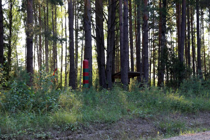
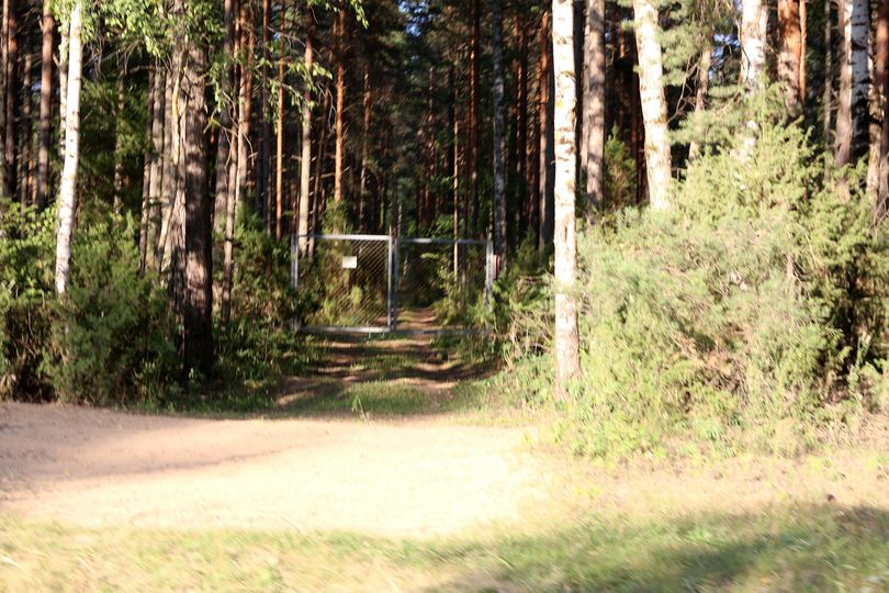
In Russia Not that much to see here. Remarcable however is this fence. The picture is not that sharp but I don't have to explain why. |
|
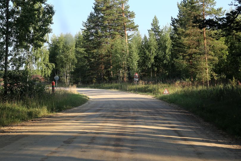
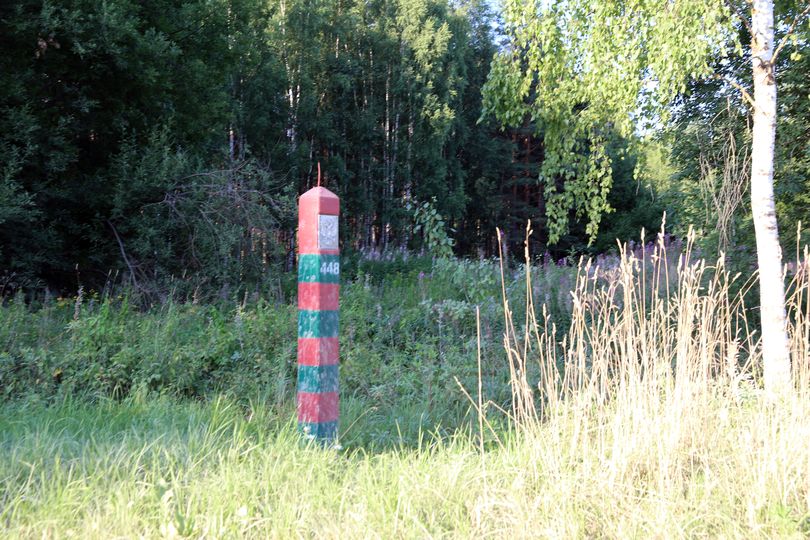
End of Russian zone Here the border crosses the road again. End of the Russian zone at border marker 448. I really wonder how long this unique situation will last. |
| EE-RU I | Estonia-Russia II | EE-RU III | EE-RU IV | EE-RU V | EE-RU-LV | LV-RU I | LV-RU II | LV-RU III | LV-RU IV | >> |